
Aerial LiDAR
What is LiDAR?
LiDAR (Light Detection and Ranging) is an active sensor that captures three-dimensional information of the Earth’s surface. Pulses of light are sent from the sensor to the ground, and the time it takes for that pulse to reach a feature on the surface and return to the sensor provides an exact measurement of distance. Those distances and the airplane’s precise location, as measured by GPS, are combined to create a LiDAR point cloud. LiDAR is a fast and efficient method for gathering accurate information about a specific area. Applications for LiDAR can include 3D maps and models, survey assessments, forest inventories, floodplain evaluations, disaster management, utility corridor monitoring, transportation planning, geomorphology analyses, urban planning, landscape ecology, coastal engineering, and volumetric calculations.
Why Choose Keystone to Collect LiDAR Data?
For over a decade, Keystone has been delivering industry-leading LiDAR data for a variety of applications to both the private and public sector. Utilizing our aircraft and state-of-the-art LiDAR sensors, we collect and process highly accurate LiDAR data while adhering to strict quality standards. Our LiDAR systems provide incredibly accurate elevations at a wide variety of densities over large and small areas. Each project is tailored to suit our client’s needs.
Aircraft and Sensors
Keystone tailors our data collection to our clients’ needs so you have a comprehensive dataset that works for you.
We do this by utilizing one of our 30+ aerial-survey-specific aircraft and some of the most advanced remote sensing sensors on the market.
Innovation at its’ best!

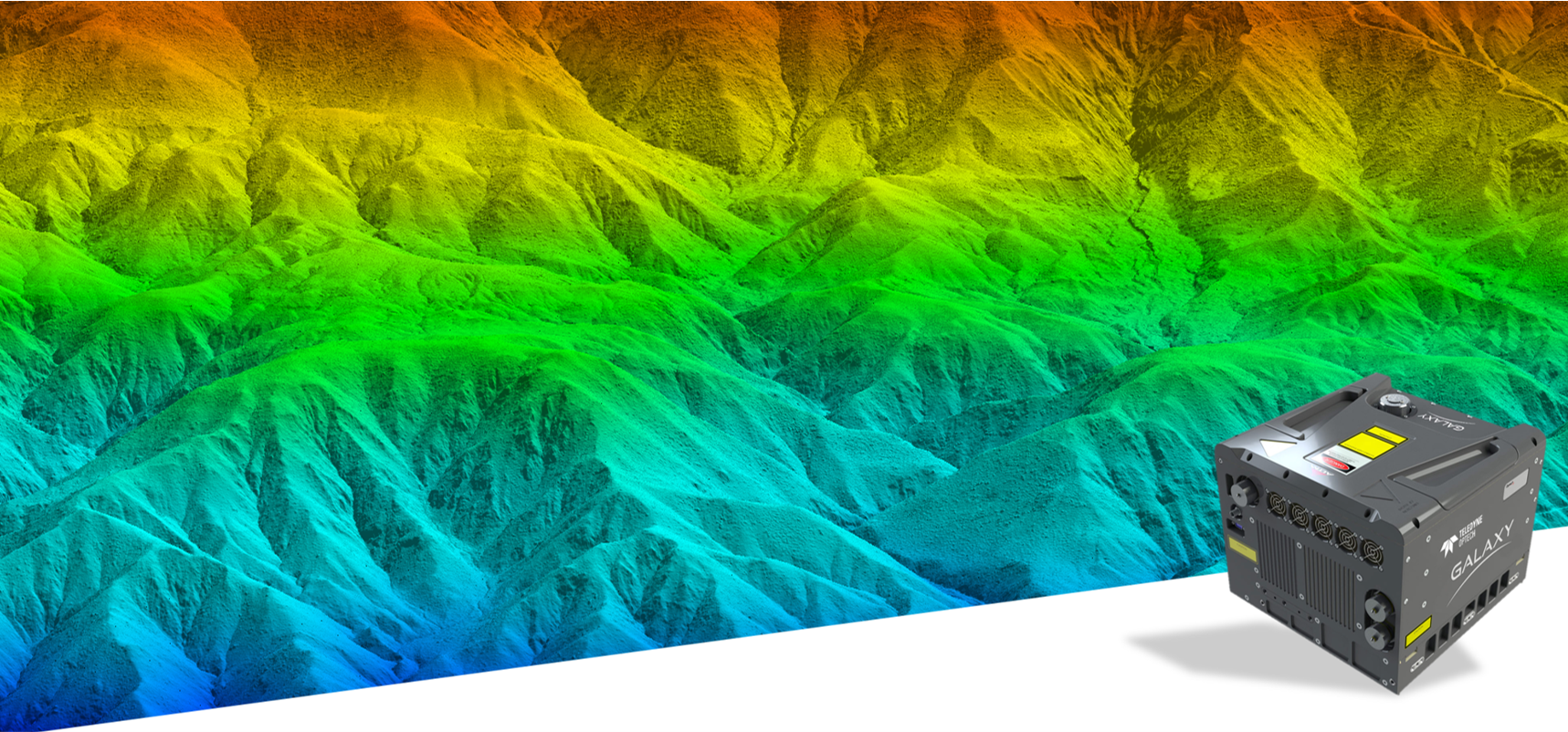
The Galaxy Prime is the next generation of airborne LiDAR solutions, packing more power and accuracy into a tiny footprint than any other sensor. Designed for everything from wide-area mapping to corridor surveys, the Galaxy Prime is truly a universal sensor that rivals larger systems with its ultra-dense data and industry-leading measurement precision and accuracy.
The Galaxy Prime utilizes Teledyne Optech’s innovative technology which maximizes productivity and reduces overhead costs:
The SwathTRAK™ feature allows the sensor to adjust the field of view during collection so the width of the swath is consistent over varied terrain
The PulseTRAK™ feature enables consistent point density without receiver “blind” zones and offers complete collection freedom irrespective of terrain variability.
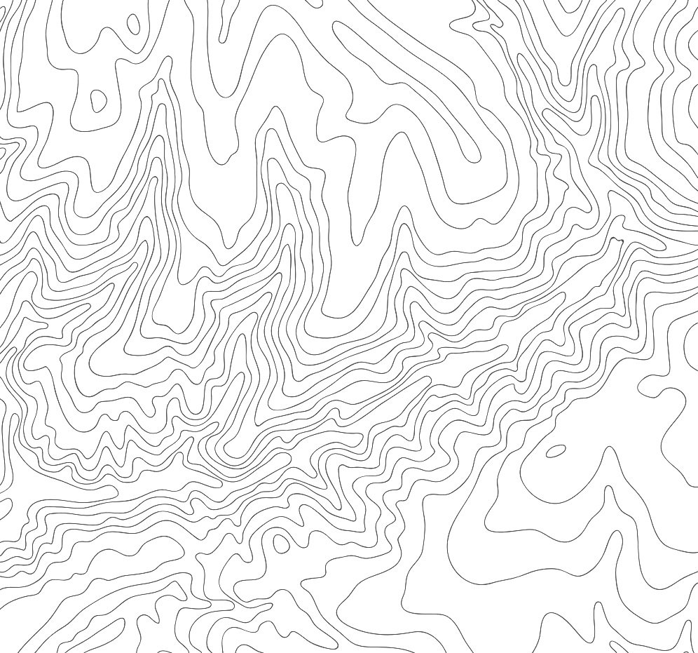
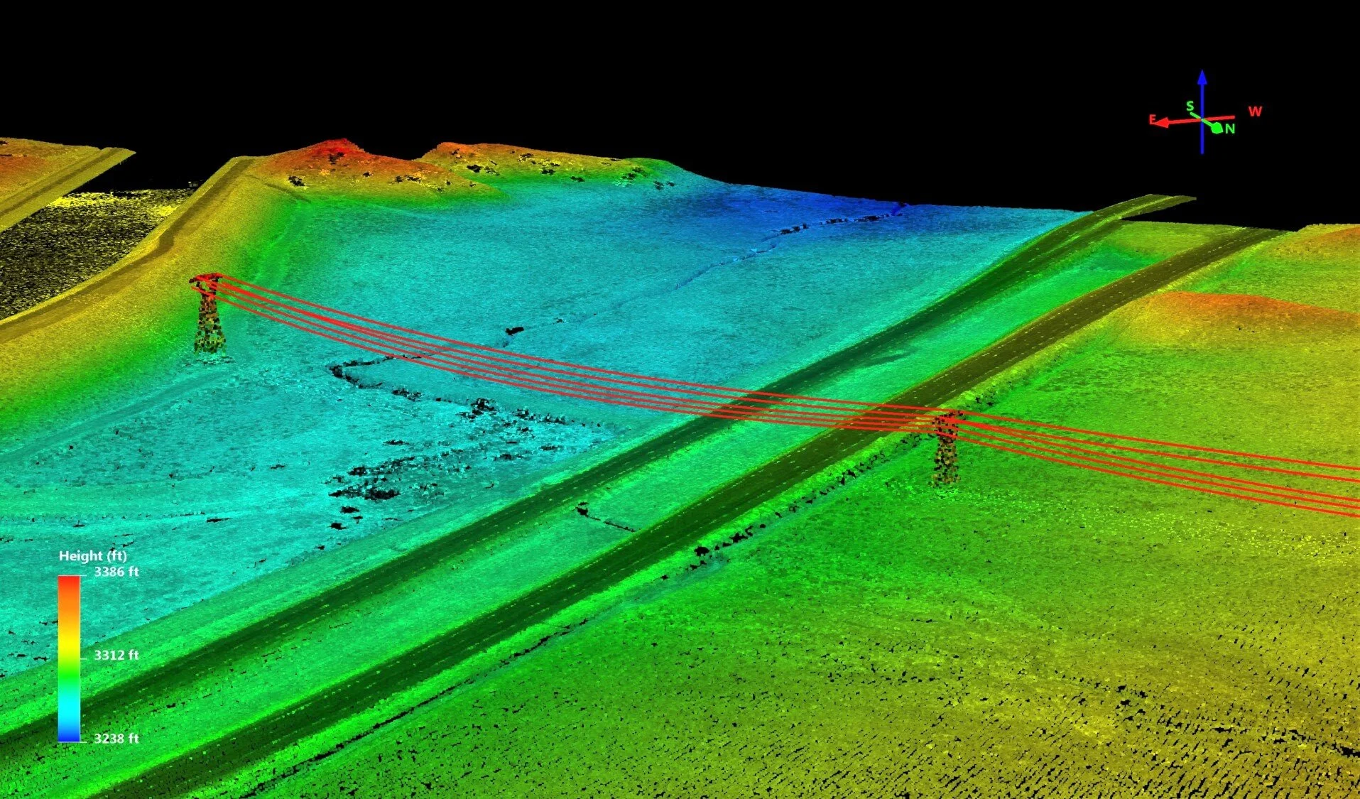
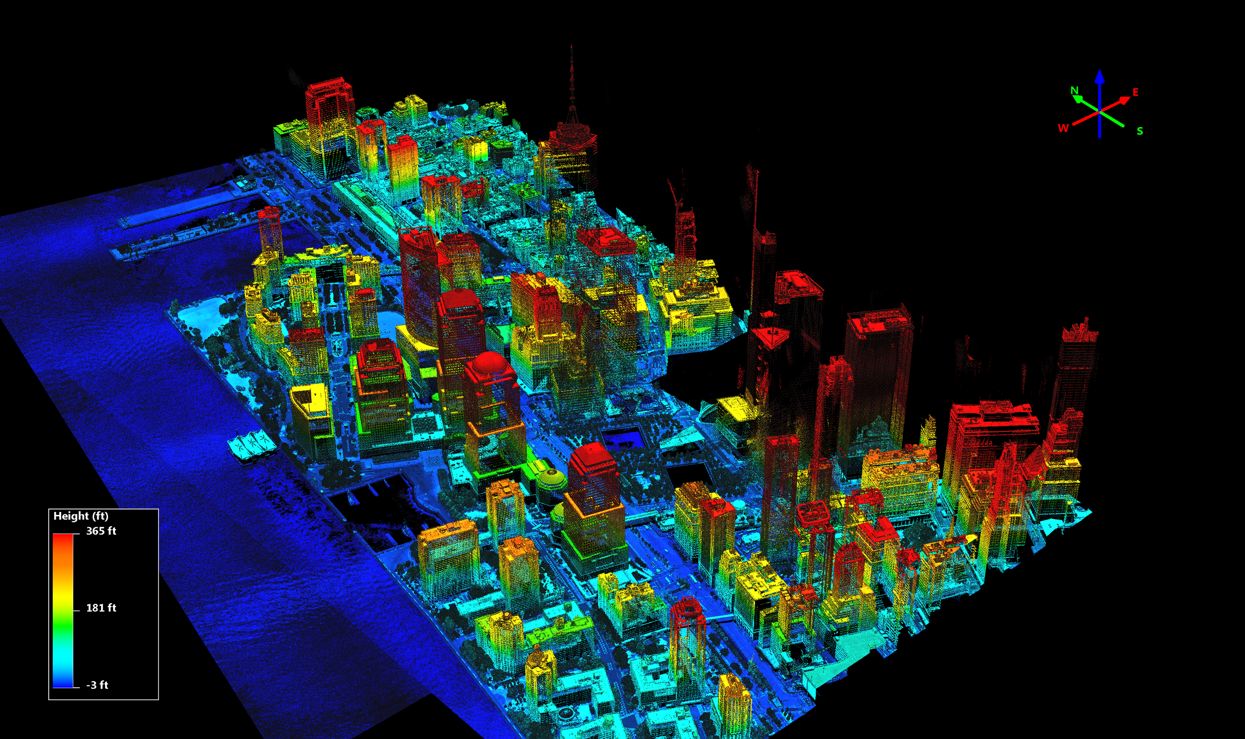
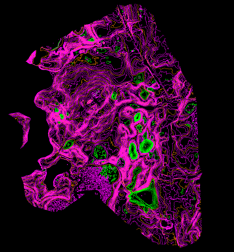
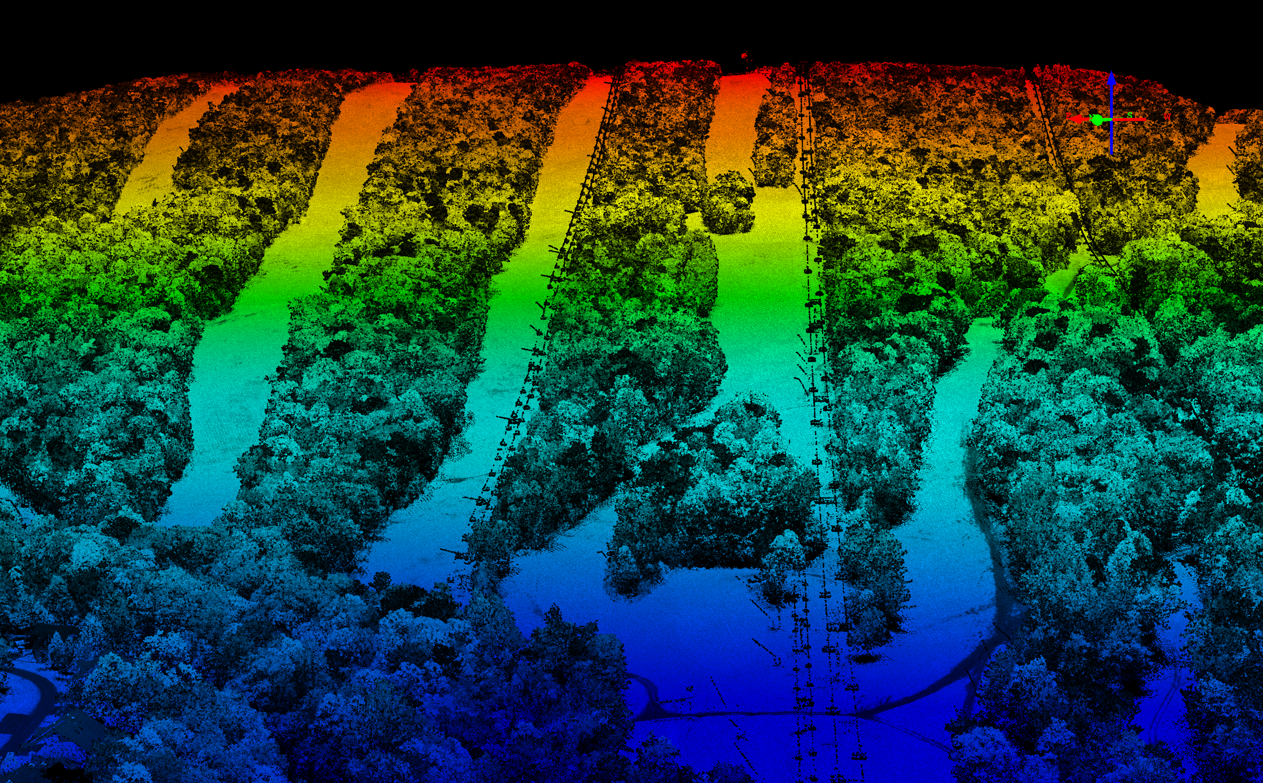
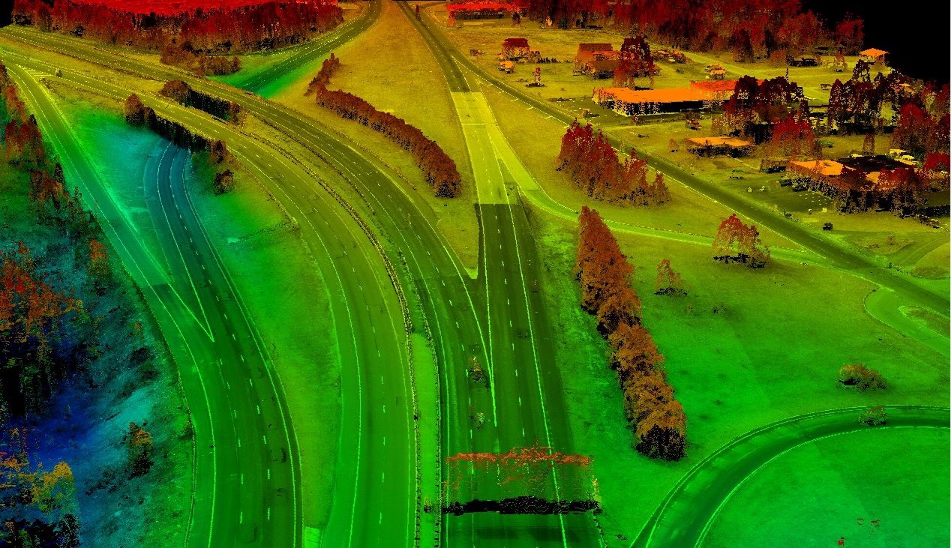
LiDAR Product Samples


Do you want to learn more about our LiDAR services?
Reach out to us today to discuss your next project!